Map Reading Across the Continents
Session 2: Learning Tasks and Practice
We're going to be talking about two different types of maps in this class: physical maps and political maps. Click on each map below to look more closely at the differences.
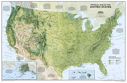
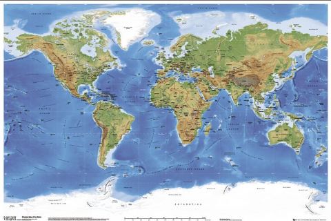
Physical Maps
These maps shows physical features- mountains, valleys, rivers, lakes, and other natural elements.


Political Maps
These maps show where different man-made areas are divided. The lines divide up different continents, countries, states, counties, and other man-made areas. Notice how the map makers made these areas different colors so they stand apart more easily. If you were looking at these areas from outer space, you wouldn't see those lines or colors. They're just there to help us identify the different continents, countries, states, counties, and other man-made areas.


Notice that both types of maps have different colors.
- Blue represents water- either the ocean, lakes, rivers, or other bodies of water.
- The other colors represent land.
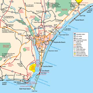
Reading a Political Map
Let's take a closer look at political maps. What are all those little marks on the map? What do they mean?

Dots or circles represent towns or cities on a political map. If the dot and the writing is small, the town is smaller. Bigger dots or circles represent larger cities.
Find Charlotte on the map of North Carolina above. Charlotte is the biggest city in North Carolina and therefore is written larger and is easier to find. Now find Hickory. Hickory is still a medium size city, so it is slightly smaller. Now look for Whiteville. (Clue: It's close to the ocean and Wilmington.) It might be harder to find because it's a smaller city.
Did you find all three cities? Click here to see them circled.
Now you're ready to wrap up Session #2!
Go back to Session #2 to finish up!